Destination
NORTHERN CIRCUIT – TANZANIA
ARUSHA NATIONAL PARK
Arusha National Park covers Mount Meru, a prominent volcano with an elevation of 4566 m, in the Arusha Region of north eastern Tanzania. The park is small but varied with spectacular landscapes in three distinct areas. In the west, the Meru Crater funnels the Jekukumia River; the peak of Mount Meru lies on its rim. Ngurdoto Crater in the south-east is grassland. The shallow alkaline Momella Lakes in the north-east have varying algal colors and are known for their wading birds.
Mount Meru is the second highest peak in Tanzania after Mount Kilimanjaro, which is just 60 km away and forms a backdrop to views from the park to the east. Arusha National Park lies on a 300-kilometre axis of Africa’s most famous national parks, running from Serengeti and Ngorongoro Crater in the west to Kilimanjaro National Park in the east.
Arusha National Park has a rich variety of wildlife, but visitors shouldn’t expect the same game-viewing experience they find in other national parks of Tanzania’s northern circuit. Despite the small size of the park, common animals include giraffe, buffalo, zebra, warthog, the black-and-white colobus monkey, the blue monkey, flamingos and more. African elephants and leopards are present, but rarely seen. There are no lions in the park. Birdlife in the forest is prolific, with many forest species more easily seen here than elsewhere on the tourist route – Narina Trogon and Bar-tailed Trogon are both possible highlights for visiting birders, whilst the range of starling species provide somewhat less gaudy interest.


KILIMANJARO NATIONAL PARK
Kilimanjaro National Park is a Tanzanian national park, located 200 miles south of the equator in Kilimanjaro Region, Tanzania. The national park is located near the city of Moshi. The park includes the whole of Mount Kilimanjaro above the tree line and six forest corridors stretching down through the montane forest belt. It covers an area of 753 km2 (291 sq mi) from 2°45’–3°25’S, 37°00’–37°43’E. The park is administered by the Tanzania National Parks Authority.
A variety of animals can be found in the park. Above the timberline, Kilimanjaro tree hyrax, a vulnerable species, common duiker and rodents are frequently encountered. Another vulnerable species, Abbott’s duiker, is restricted to Kilimanjaro and some neighboring mountains. In the montane forests among others, blue monkey, western black and white colobus, bushbaby, and leopards can be found.
Mount Kilimanjaro
Kilimanjaro, with its three volcanic cones, Kibo 5,895 m (19,341 ft), Mawenzi 5,149 m (16,893 ft), and Shira 3,962 m (13,000 ft), is a dormant volcanic mountain in Kilimanjaro National Park, Kilimanjaro Region, Tanzania. It is the highest mountain in Tanzania, the highest mountain in Africa, and the highest free-standing mountain in the world at 5,895 meters or 19,341 feet above sea level (the Uhuru Peak/Kibo Peak). A private organization in February 2013 designated Mount Kilimanjaro as one of the seven natural wonders of Africa.
There are six official trekking routes by which to climb Mt Kilimanjaro, namely: Marangu, Rongai, Lemosho, Shira, Umbwe and Machame. Of all the routes, Machame is by far the most scenic albeit steeper route up the mountain, which can be done in six or seven days. The Rongai is the easiest and least scenic of all camping routes with the most difficult summit night and the Marangu is also relatively easy, but accommodation is in shared huts with all other climbers. As a result, this route tends to be very busy, and ascent and descent routes are the same.
Being an Afromontane sky island, Kilimanjaro has enormous biodiversity while low in endemic species. However endemics include the giant groundsels in the bunchgrass tussock grasslands, and other flora adapted to living in alpine plant conditions.
Kilimanjaro has a large variety of forest types over an altitudinal range of 3,000 m (9,843 ft) containing over 1,200 vascular plant species. Montane Ocotea forests occur on the wet southern slope. Cassipourea and Juniperus forests grow on the dry northern slope. Subalpine Erica forests at 4,100 m (13,451 ft) represent the highest elevation cloud forests in Africa. In contrast to this enormous biodiversity, the degree of endemism is low. However, forest relicts in the deepest valleys of the cultivated lower areas suggest that a rich forest flora inhabited Mt Kilimanjaro in the past, with restricted-range species otherwise only known from the Eastern Arc mountains. The low degree of endemism on Kilimanjaro may result from destruction of lower elevation forest rather than the relatively young age of the mountain.
Another feature of the forests of Kilimanjaro is the absence of a bamboo zone, which occurs on all other tall mountains in East Africa with a similarly high rainfall. Sinarundinaria alpina stands are favoured by elephants and African buffalos elsewhere. On Kilimanjaro these megaherbivores occur on the northern slopes, where it is too dry for a large bamboo zone to develop. They are excluded from the wet southern slope forests by topography and humans, who have cultivated the foothills for at least 2000 years.
This interplay of biotic and abiotic factors could explain not only the lack of a bamboo zone on Kilimanjaro but also offers possible explanations for the patterns of diversity and endemism. If true, Kilimanjaro’s forests would serve as a striking example of the large and long-lasting influence of both animals and humans on the African landscape.

LAKE EYASI
Lake Eyasi is a seasonal shallow endorheic salt lake on the floor of the Great Rift Valley at the base of the Serengeti Plateau, just south of the Serengeti National Park and immediately southwest of the Ngorongoro Crater in the Crater Highlands of Tanzania. The lake is elongated, orientated southwest to northeast, and lies in the Eyasi-Wembere branch of the Great Rift Valley.
The principal inflow is the Sibiti River, which enters the southwestern end. The river may continue to flow somewhat year round, at least in wetter years; the other inflows are all seasonal. The second largest inflow is the Baray, at the northeast. The water carried by the Baray has increased in recent years due to deforestation of the Crater Highlands. The southwest flank of Mount Oldeani, one of the Ngorongoro volcanos, drains directly into the northeast end of the lake. Flow from the Budahaya / Udahaya River, which drains into the Yaeda Swamp to the southeast of the lake, was once second, but has decreased due to water diversion in the Mbulu Highlands. Water flow from the Serengeti is minor; the largest stream is the Sayu.
Seasonal water level fluctuations in the lake are dramatic, though the northwestern shore is constrained by the cliffs of the Serengeti Plateau. During the dry season the lake may dry up almost entirely, especially in drier years, so that Datooga herders and Hadza foragers will cross the lake on foot, but in El Niño years it may flood its banks and attract hippopotamus from the Serengeti. It is a seasonal stop for migrating flamingos. The lake supports minor local fishing in wet years, but more often catfish and lungfish are taken from the streams and springs that feed the lake. Even during wet periods, lake depths typically remain less than one metre.


LAKE MANYARA NATIONAL PARK
Lake Manyara National Park is a Tanzanian national park located both in Arusha Region and Manyara Region, Tanzania. The two administrative regions have no jurisdiction over the parks. The park is governed by the Tanzania National Parks Authority. The majority of the land area of the park is a narrow strip running between the Gregory Rift wall to the west and Lake Manyara, an alkaline or soda-lake, to the east.
The park consists of 330 km2 (130 sq mi) of arid land, forest, and a soda-lake which covers as much as 200 km2 (77 sq mi) of land during the wet season but is nearly nonexistent during the dry season. Lake Manyara National Park has located 126 km (78 mi) south west of Arusha and can be reached by car in an hour and a half. The park can also be reached easily from Babati the capital of Manyara Region.
Lake Manyara National Park is known for the flamingos that inhabit the lake. During the wet season they inhabit the edges of the lake in flocks of thousands but they are not so present during the dry season. More than 400 species of birds inhabit the park and many remain throughout the year. Because of this Lake Manyara National Park is a good spot for bird watching. Visitors to the park can expect to see upwards of 100 different species of bird on any day.
Leopards, lions, elephants, blue monkeys, dik-dik, gazelle, hippo, giraffe, impala, and more inhabit the park and many can be seen throughout the year. There is a hippo pond at one end of the park where visitors can get out of their cars and observe from a safe distance. The leopards and lions are both known to lounge in the trees while not hunting for prey.


MKOMAZI NATIONAL PARK
Mkomazi National Park is located in North Eastern Tanzania on the Kenyan Border. It was established in 1951 and is found in Kilimanjaro Region and Tanga Region.
The Reserve covers over 3,200 km² and is dominated by Acacia-Commiphora vegetation; it is contiguous with Kenya’s Tsavo East National Park. The area commonly called ‘Mkomazi’ is actually the union of two Game Reserves, the Umba Game Reserve in the east (in Lushoto District, Tanga Region) and the Mkomazi Game Reserve in the West (in Same District, Kilimanjaro Region); in government documents they are sometimes called the Mkomazi/Umba Game Reserves. Of the two, Mkomazi is larger, and has more diversity of relief and habitat, and a longer shared border with Tsavo East National Park. In the rest of this entry ‘Mkomazi’ will refer to both the Mkomazi and Umba Reserves together.

NGORONGORO CONSERVATION AREA
The Ngorongoro Conservation Area (NCA) is a conservation area and a UNESCO World Heritage Site located 180 km (110 mi) west of Arusha in the Crater Highlands area of Tanzania. Ngorongoro Crater, a large volcanic caldera within the area, is recognized by one private organization as one of the seven natural wonders of Africa. The conservation area is administered by the Ngorongoro Conservation Area Authority, an arm of the Tanzanian government, and its boundaries follow the boundary of the Ngorongoro Division of the Arusha Region.
Ngorongoro Crater
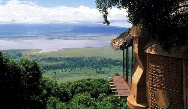
The main feature of the Ngorongoro Conservation Authority is the Ngorongoro Crater, the world’s largest inactive, intact, and unfilled volcanic caldera. The crater, which formed when a large volcano exploded and collapsed on itself two to three million years ago, is 610 metres (2,000 feet) deep and its floor covers 260 square kilometres (100 square miles). Estimates of the height of the original volcano range from 4,500 to 5,800 metres (14,800 to 19,000 feet) high. The elevation of the crater floor is 1,800 metres (5,900 feet) above sea level.
The crater highlands on the side facing the easterly trade winds receives 800 to 1,200 millimeters (31 to 47 inches) of rain a year and are covered largely in montane forest. The less-steep west wall receives only 400 to 600 millimeters (16 to 24 inches) and is grassland and bushland dotted with Euphorbia bussei trees. The crater floor is mostly open grassland with two small wooded areas dominated by Acacia xanthophloea.
The Munge Stream drains Olmoti Crater to the north and is the main water source draining into the seasonal salt lake in the center of the crater. This lake is known by two names: Makat as the Maasai called it, meaning salt; and Magadi. The Lerai Stream drains the humid forests to the south of the Crater, and it feeds the Lerai Forest on the crater floor – when there is enough rain, the Lerai drains into Lake Magadi as well. Extraction of water by lodges and NCA headquarters reduces the amount of water entering Lerai by around 25 percent.
The other major water source in the crater is the Ngoitokitok Spring, near the eastern crater wall. There is a picnic site here open to tourists and a huge swamp fed by the spring, and the area is inhabited by hippopotamus, elephants, lions, and many others. Many other small springs can be found around the crater’s floor, and these are important water supplies for the animals and local Masaai, especially during times of drought.
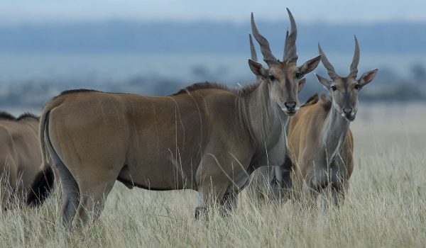
Approximately 25,000 large animals, mostly ungulates, live in the crater. Large animals in the crater include the black rhinoceros, the local population of which declined from about 108 in 1964-66 to between 11-14 in 1995, and the hippopotamus. There also are many other ungulates: the wildebeest (7,000), Burchell’s zebra (4,000), the common eland, and Grant’s and Thomson’s gazelles (3,000). Waterbuck occur mainly near Lerai Forest. There are no topis, oribis, or crocodiles. Impala is absent because the open woodland they prefer does not exist. Giraffe also is absent, possibly because of a lack of browse species. Cheetah, African wild dog, and leopard are rarely seen.
Although the thought of as “a natural enclosure” for a very wide variety of wildlife, 20 percent or more of the wildebeest and half the zebra populations vacate the crater in the wet season. Buffalo and eland do the opposite. Their highest numbers are during the rains. The crater has one of the densest known population of lions, numbering 62.
Olduvai Gorge
The Ngorongoro Conservation Area also protects Olduvai Gorge, situated in the plains area. It is considered to be the seat of humanity after the discovery of the earliest known specimens of the human genus, Homo habilis as well as early hominidae, such as Paranthropus boisei.
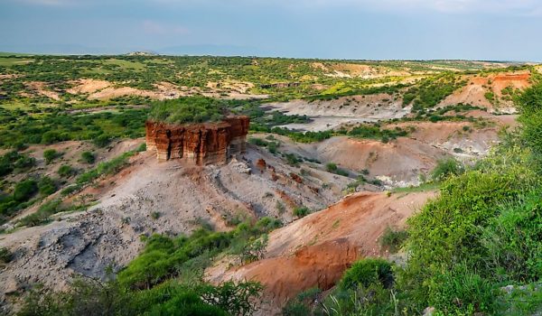
The Olduvai Gorge or Oldupai Gorge is a steep-sided ravine in the Great Rift Valley, which stretches along eastern Africa. Olduvai is in the eastern Serengeti Plains in northern Tanzania and is about 30 miles long. It lies in the rain shadow of the Ngorongoro highlands and is the driest part of the region. The gorge is named after ‘Oldupaai’, the Maasai word for the wild sisal plant, Sansevieria ehrenbergii.
It is one of the most important prehistoric sites in the world and research there has been instrumental in furthering understanding of early human evolution. Excavation work there was pioneered by Mary and Louis Leakey in the 1950s and is continued today by their family. Some believe that millions of years ago, the site was that of a large lake, the shores of which were covered with successive deposits of volcanic ash. Around 500,000 years ago seismic activity diverted a nearby stream which began to cut down into the sediments, revealing seven main layers in the walls of the gorge.
SERENGETI NATIONAL PARK
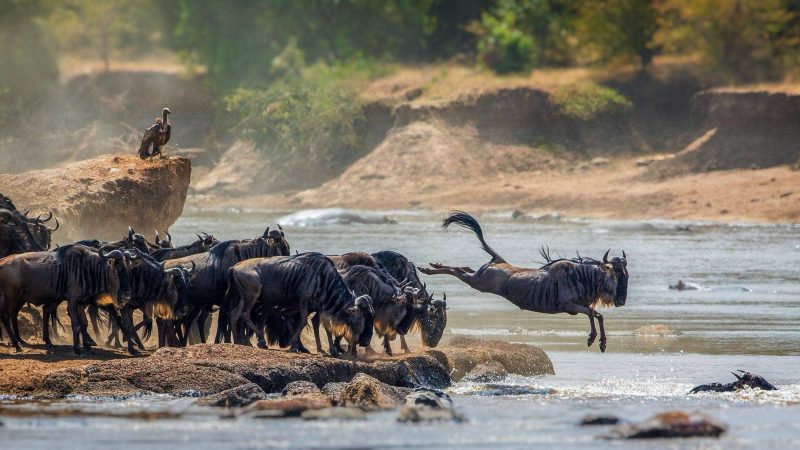
The Serengeti National Park is a Tanzanian national park in the Serengeti ecosystem in Mara Region. It is famous for its annual migration of over 1.5 million white bearded (or brindled) wildebeest and 250,000 zebra and for its numerous Nile crocodile.
The park covers 14,763 km2 (5,700 sq mi) of grassland plains and savanna as well as riverine forest and woodlands. The park lies in the north of Tanzania, bordered to the north by the Kenyan border, where it is continuous with the Maasai Mara National Reserve. To the southeast of the park is Ngorongoro Conservation Area, to the southwest lies Maswa Game Reserve, to the west are the Ikorongo and Grumeti Game Reserves, and to the northeast lies the Loliondo Game Control Area. Together, these areas form the larger Serengeti ecosystem.
As well as the migration of ungulates, the park is well known for its healthy stock of other resident wildlife, particularly the “Big Five”, named for the five most prized trophies taken by hunters:
- Lion: the Serengeti is believed to hold the largest population of lions in Africa due in part to the abundance of prey species. More than 3,000 lions live in this ecosystem.
- African Leopard: these reclusive predators are commonly seen in the Seronera region but are present throughout the national park with the population at around 1,000.
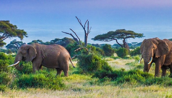
- African Elephant: the herds are recovering from population lows in the 1980s caused by poaching and are largely located in the northern regions of the park.
- Black Rhinoceros: mainly found around the kopjes in the centre of the park, very few individuals remain due to rampant poaching. Individuals from the Masai Mara Reserve cross the park border and enter Serengeti from the northern section at times.
- African Buffalo: still abundant and present in healthy numbers, but numbers have been somewhat reduced due to disease.
The park also supports many other species, including cheetah, Thomson’s and Grant’s gazelle, topi, eland, waterbuck, hyena, baboon, impala, African wild dog, and giraffe. The park also boasts about 500 bird species, including ostrich, secretary bird, Kori bustard, crowned crane, marabou stork, martial eagle, lovebirds, and many species of vultures.

TARANGIRE NATIONAL PARK
Tarangire National Park is the sixth largest national park in Tanzania after Ruaha, Serengeti, Mikumi, Katavi and Mkomazi. The national park is located in Manyara Region. The name of the park originates from the Tarangire river that crosses through the park, being the only source of water for wild animals during dry seasons. During the dry season thousands of animals migrate to the Tarangire National Park from Manyara National Park.
It lies a little distance to the south east of Lake Manyara and covers an area of approximately 2,850 square kilometers(1,100 square miles.) The landscape and vegetation is incredibly diverse with a mix that is not found anywhere else in the northern safari circuit. The hilly landscape is dotted with vast numbers of Baobab trees, dense bush and high grasses.
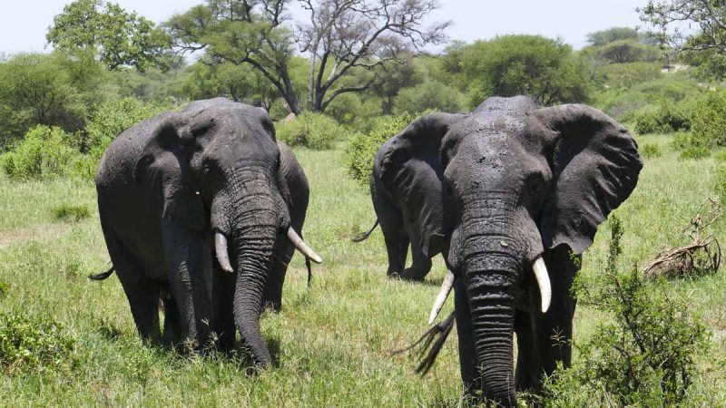
The park is famous for its huge number of elephants, baobab trees and tree climbing lions. Visitors to the park can expect to see any number of resident zebra and wildebeest in addition to the less common animals. Other common animals include waterbuck, giraffe, and olive baboons.
Home to more than 550 species, the park is a haven for bird enthusiasts who can expect so see dozens of species even in the dry season. The swamps are the focus of the largest selection of breeding birds anywhere in the world. Yellow-collared Lovebirds are a common bird sighting in the trees along the Tarangire River.
The park is also famous for the termite mounds that dot the landscape. Those that have been abandoned are often seen to be home to dwarf mongoose.
