7 Days Rongai Route
Tour Overview
The Rongai route is the only easy route starting from the North and offers great views of the Kenyan savannahs.
It wasn’t used for a while as the border was not deemed safe, but now the trail is open again. It is much drier than the other routes and you might even encounter an elephant on the way.
Day by day Itinerary
To Simba (first) Cave 1950m to 2600m (6400ft to 8500ft)
From Moshi, we first go to the Marangu park headquarters. Then we take a long drive along the Tanzanian/Kenyan border until we reach Rongai where we head up the mountain. From the Park gate, we follow an old 4wd track through the forest and heather.
Lots of Elephant dung is to be found and we might spot one of the ‘droppers’ ourselves! We sleep at the 1st Cave, no hut.
To Kikelewa (Second) Cave 2600m to 3600m (8500ft to 11,800ft)
We leave camp and cross the moorland with good views of Kibo, the Eastern Icefields and Mawenzi. we pass the 2nd Rongai Cave at 3450m where the track splits: straight ahead is possible,
we go left (east) towards Mawenzi for better acclimatization. The campsite is in a sheltered valley near the Kikelewa Caves at 3600m.
To Mawenzi Tarn 3600m to 4330m (11,800ft to 14,200ft)
Today is not long, but steeper than before (not technical). The campsite is at the “Mawenzi Tarn”, situated in directly beneath the rugged rocks of 5149 m high Mawenzi. You can walk around if you like or just rest and acclimatize.
Extra days can be spent here for a better chance of summiting or for climbing Mawenzi (technical rock/ice), which is seldom done.
Mawenzi Tarn
Today is an acclimatization day at Mawenzi Tarn. You can hike in the area or just relax at camp, both will help for the days ahead.
To School Camp – 4330m to 4750m
We cross the wide plateau aptly called “the Saddle” between Mawenzi and Kibo. We arrive at the School camp where the direct track from 1st cave also end up. Today is not a long or hard day, so you can start preparing mentally and physically (resting and eating/drinking a lot) for the summit bid which will start the next morning.
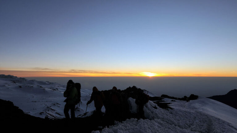
To Summit and Horombo camp Hut – 4600m to 5895m (and down to 3720m)
Early morning, we continue our way via zigzags to the summit of Uhuru Peak at 5,985 meters. You will have to join the crowds from the normal (Marangu or Coca-Cola) route up until Gillman’s point (5735), where most of the fast up and down tourists will have had enough.
At Uhuru Peak, we have reached the highest point on Mount Kilimanjaro and the continent of Africa. Faster hikers will see the sunrise from the summit. From the summit, we now make our descent continuing straight down to the Horombo Hut campsite at 3720 meters.
This part of the descent takes about 5 hours. You will want gaiters and trekking poles for the loose gravel going down. Later in the evening, we enjoy our last dinner on the mountain and a well-earned sleep.
To Marangu & Moshi – 3720m to 1800m
After breakfast, we continue the descent down to the Marangu Park Gate. At lower elevations, it can be wet and muddy. Gaiters and trekking poles will help. Shorts and t-shirts will probably be plenty to wear (keep rain gear and warmer clothing handy). A vehicle will meet you at Marangu to drive you back to the hotel in Moshi.
Don’t forget to tip your guides and porters. It is time for celebration! Hotel in Moshi is included in our trips.


Enquire This Tour
Ask Our Expert
- +255 784 688 933